
Yesterday’s weather saw the warmest temperatures, around 85 F, at midnight. They fell after a broken line of showers and storms passed through the area, levelled out at 75 F during the day, and resumed their fall as the sun set. Nighttime high temperatures are seen more often in winter than in summer, but the outgoing airmass was hot and the one we enjoyed today is from the northern Great Lakes.
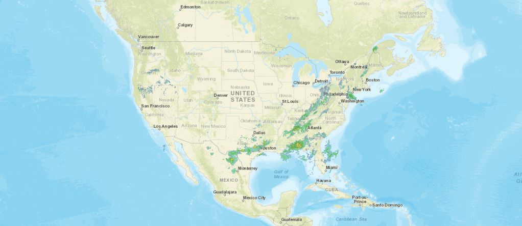
Conditions at 11 pm EDT, June 21

We are under an area of high pressure, on the side which tends to transport air from points north. The cold front has pushed precipitation well to our southeast.
The clouds from this morning partially cleared by sunset as drier air came in from the northwest.
Forecast for June 22-23
Today will be a fairly raw day for mid-June. Temperatures will struggle toward 70 F at best. Clouds will increase as the day goes on, with a possible drop or two of rain. There may be a little clearing as sunset approaches and the frigid air a mile above us begins to moderate.
Tonight will be cool, with mostly cloudy skies. GFS suggests 52 F as the low temperature Wednesday morning, but it’s sort of hard to see how we go from 72 F to 52 F on a short, cloudy June night.
Tomorrow will see the clouds persist, though we will have exchange low-level stratus for mid-level clouds. It will be the kind of day that the Irish call “bright”: little sun but not nearly as gloomy as today. High temperatures will be in the low to mid 70s. Little to no rain is expected here, though metro Chicago will see light showers.
