June 22 forecast was a bust: Predicted 55/68. Actual 53/80.
The main reason for a bust was probably that I trusted the model sounding too much. The GFS sounding showed relative humidities of 100% at 850 hPa (about a mile above sea level) when in fact it was 71% at Lincoln, IL. Wilmington, Ohio peaked near 90% — so it was a “close” call of 200 miles.
Fewer clouds than predicted let temperatures fall freely toward the dewpoint (around 47 F) before dawn though perhaps 2 F of difference is not a bust.
Under bright sunshine for most of the day, temperatures rose to 80 F at Purdue. The Northern Indiana WFO, near Syracuse/North Webster in northeast Indiana, only reached 68 F.
Looking ahead: June 23
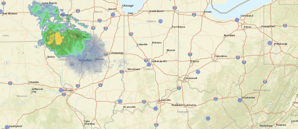
Not shown on the radar image above are some very light sprinkles along US 24 from Wolcott to Peoria. The precipitation is moving to the east-southeast, so we may get a few drops from the sprinkles now near US 24 and I-57 in Illinois before dawn and a grazing from the disturbance that extends into Iowa later in the day.
Dew points are at 51 F. Cloud cover is not too complete, so a low of 55 F seems likely.
Tomorrow we may get some remnants from the disturbance: light showers in the morning. Then the temperature will rise to the low 80s over most of Greater Lafayette, with the urban heat island and Purdue Airport more likely to see 85.
Beyond June 23: another June Monsoon?

Persistent
High
GFS Model run at 8 pm EDT, from pivotalweather.com
The daily weather setup will not repeat, but like history it will rhyme.
The story this week will be ridge of high pressure to our southwest directing disturbances our way. Over the weekend the ridge to the southwest sill recede as the ridge to the southeast and east expands. Meanwhile it will be the Pacific Northwest’s turn to be smothered by a hot ridge of high pressure. Between the two ridges, a trough will bring delightfully cool weather to the central plains and the northwestern Great Lakes.
For us, it’s the Ring of Fire. The corn will love it, with highs just right. The rest of us will not experience a perpetual rainout: just a series of little disturbances triggering (hopefully) poorly organized, garden-variety thunderstorms.
The Storm Prediction Center suggests that the severe weather will mostly stay in Iowa, though its remnants may stray into the Hoosier State on the 24th and 25th. The SPC believes that there is a risk for severe weather June 26-29, but is not too sure where (“PREDICTABILITY TOO LOW”). Their discussion is basically “Possible activity on Friday from Mid-Mississippi Valley through Southern Great Lakes” for the 25th and subsevere weather most likely in the Ring of Fire for want of strong mid-level winds. In the picture above, the midlevel flow over Indiana is 15-25 knots. Some days will see a little more, some days a little less, but it’s not likely that we’ll see enough to let thunderstorms persist. In short, “splash and dash”
Temperatures will be near seasonal norms: mostly 80s by day, 60s by night
An asterisk for Purdue Airport?
Purdue Airport’s ASOS has been running a little warmer than its neighbors. It did the same last year around this time, running 8-10 F above the neighbors (places like Terre Haute and Danville). Now it tends to run 4-6 F above the nearest statewide reporting stations. It’s not just that Purdue Airport is about 200 feet lower than most of the plain that the Wabash cuts through.
/
