To begin, here is the GFS model’s interpretation of conditions where half the atmosphere is below and the other half is above. This is known as the 500 hPa map.
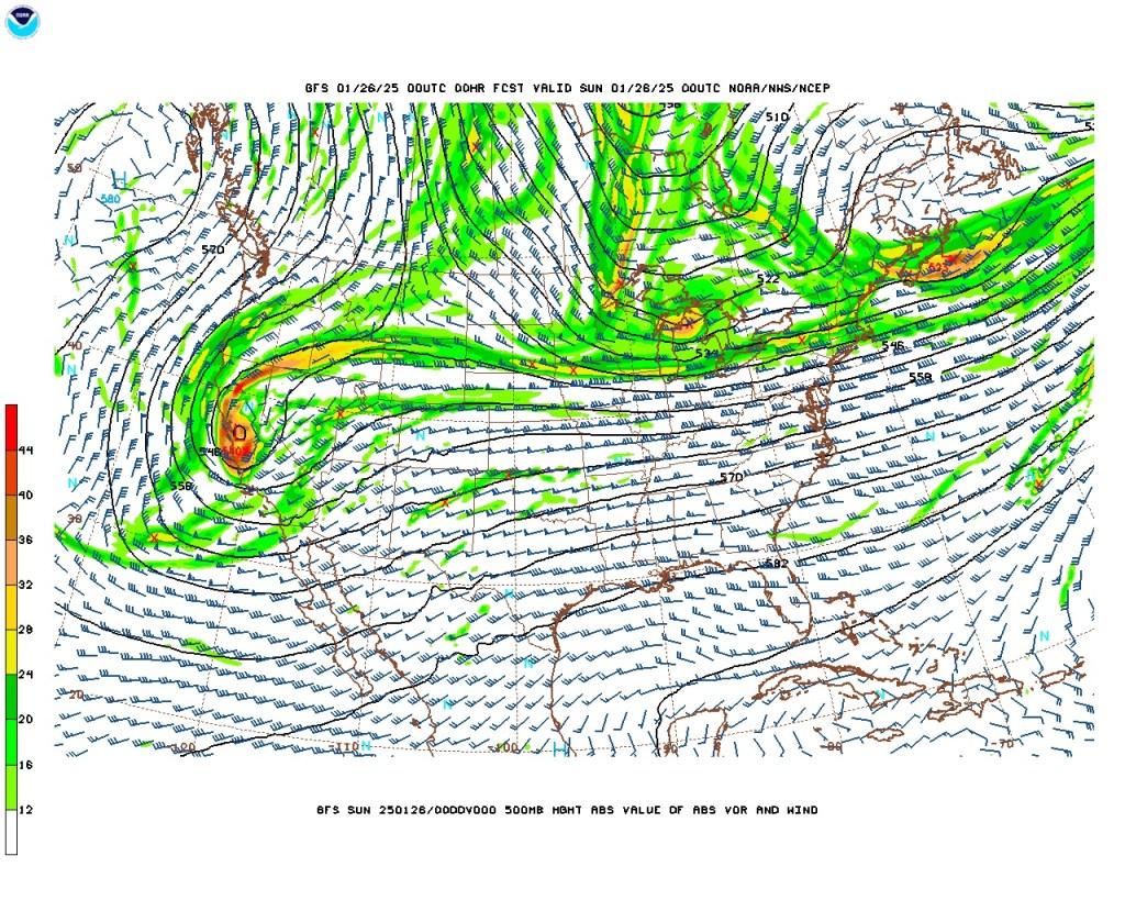
We see a low centered in central California. The colors indicate the tendency of the atmosphere to rotate and compress, called vorticity. Over Illinois and Indiana, the winds are brisk and zonal (east-west). The likely direction of the low is probably toward the southwest. For us, zonal winds mean no dramatic changes in temperature.
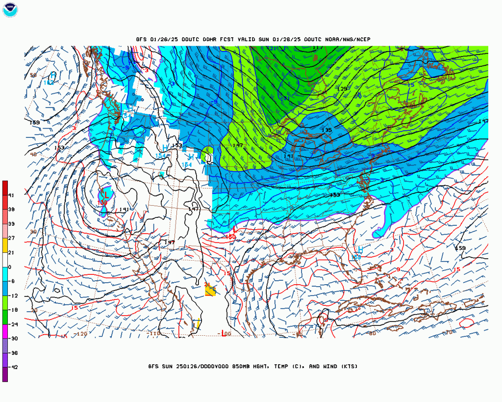
Now this is the atmosphere at 850 hPa. Since sea-level atmospheric pressure is about 1000 hPa, this represents the atmosphere where 85% lies above and 15% lies below. More practically, temperatures at this level do not vary with the time of day, at least east of the Great Plains. The wind barbs show where the wind is coming FROM. In Indiana, a slightly cooler air mass is advecting (moving) in rather slowly because the barbs are roughly parallel to the isotherms. The temperature will change more rapidly in northwestern Wisconsin even though the wind speeds are comparable because the cold air is being more directly advected into Wisconsin.

Here we are at 7 am Eastern on Sunday the 26th. Cooler air has moved in, but not much cooler. If you follow the wind barbs backward, they lead to south-central Iowa.
A rule of thumb is that the low temperature will be roughly the 850 hPa temperature, that is, -6 C or (22 F). NWS Indianapolis predicts a low of 20 F.
The satellite photos (not pictured) show Lafayette under thin clouds at most, and this will continue. With the light winds, the NWS prediction looks more reasonable.
Here my forecast stops. NWS predicts a high of 28 F tomorrow. Clear skies overnight favor cooling at night: NWS says 16 F. As the area of cold air moves north and east, pushed by southwest winds, temperatures will rise to 38, according to NWS Indianapolis. GFS says 36 F tomorrow.
In the next few days, temperatures will not vary by much. GFS sets up an 850 hPa temperature of 5 C Friday; with a weak surface low centered in Illinois, the clouds will probably keep us in the 40s.
After that, GFS starts to spin out predicting extremely mild air around February 7 followed by a cold snap. While 68 F is not unknown in February around here, it is safer to assume that GFS is predicting more extreme weather than will take place. And if you would like the 68 F, you also get the dramatic temperature drop of 40 or 50 F February 10-11 back into the twenties by day and single digits by night.
